 Geosur
remote sensing
Type of resources
Topics
INSPIRE themes
Keywords
Contact for the resource
Provided by
Formats
Representation types
Update frequencies
status
Scale
-
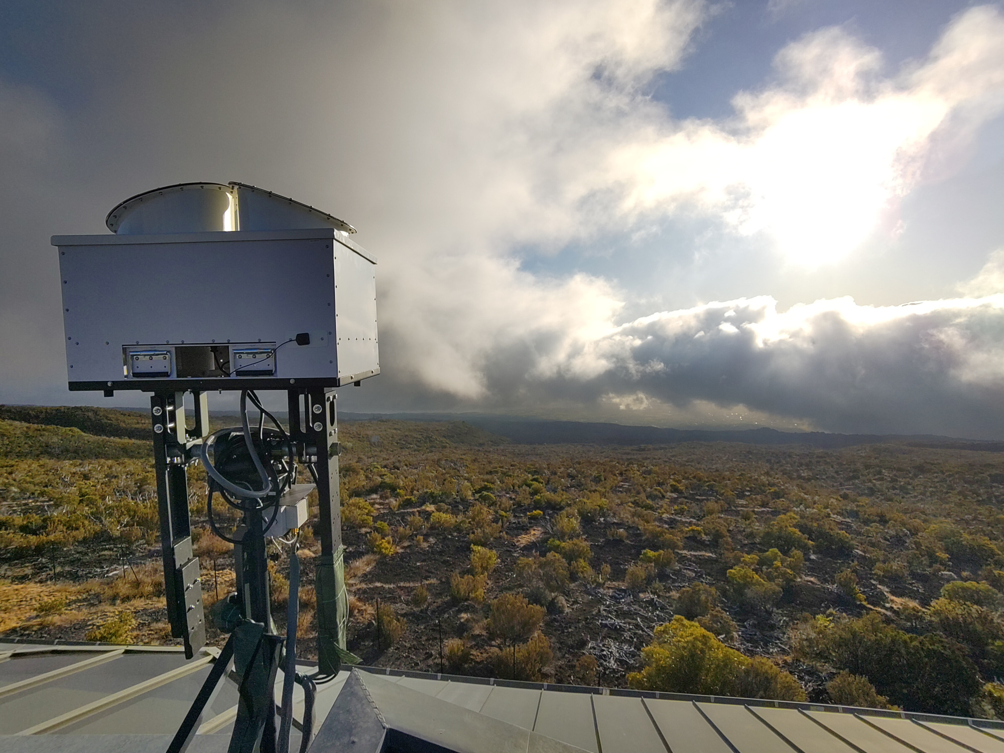
Le radar mini-BASTA est un radar nuage (95GHz) dédié à l’étude des nuages et du brouillard. Le radar mesure l’énergie rétrodiffusée par les hydrométéores, cette énergie peut donc être reliée à la quantité d’eau contenue dans le nuage (liquide et glace). Il fonctionne en routine quotidiennement sur le site de l’observatoire du Maïdo, sur l'Ile de La Réunion. Ce jeu de données est au niveau L0, et les données sont non calibrées. Paramètre principal: Profil vertical de réflectivité radar, mesure du décalage Doppler. Contexte de la mesure: observation routine.
-
.png)
Le radar BASTA est un radar nuage (95GHz) dédié à l’étude des nuages et du brouillard. Le radar mesure l’énergie rétrodiffusée par les hydrométéores, cette énergie peut donc être reliée à la quantité d’eau contenue dans le nuage (liquide et glace). Il fonctionne en routine quotidiennement sur le site de l’observatoire du Maïdo, sur l'Ile de La Réunion. Le radar BASTA Réunion a été calibré au LATMOS avant son installation à la Réunion. Ce jeu de données est au format niveau L0. Paramètre principal: Profil vertical de réflectivité radar, mesure du décalage Doppler. Contexte de la mesure: observation routine.
-
The ressource describes the dataset obtained by deploying the GAMIC GMWR-25-DP RADAR in the north of Mahé Island, in Seychelles.
-
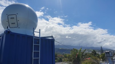
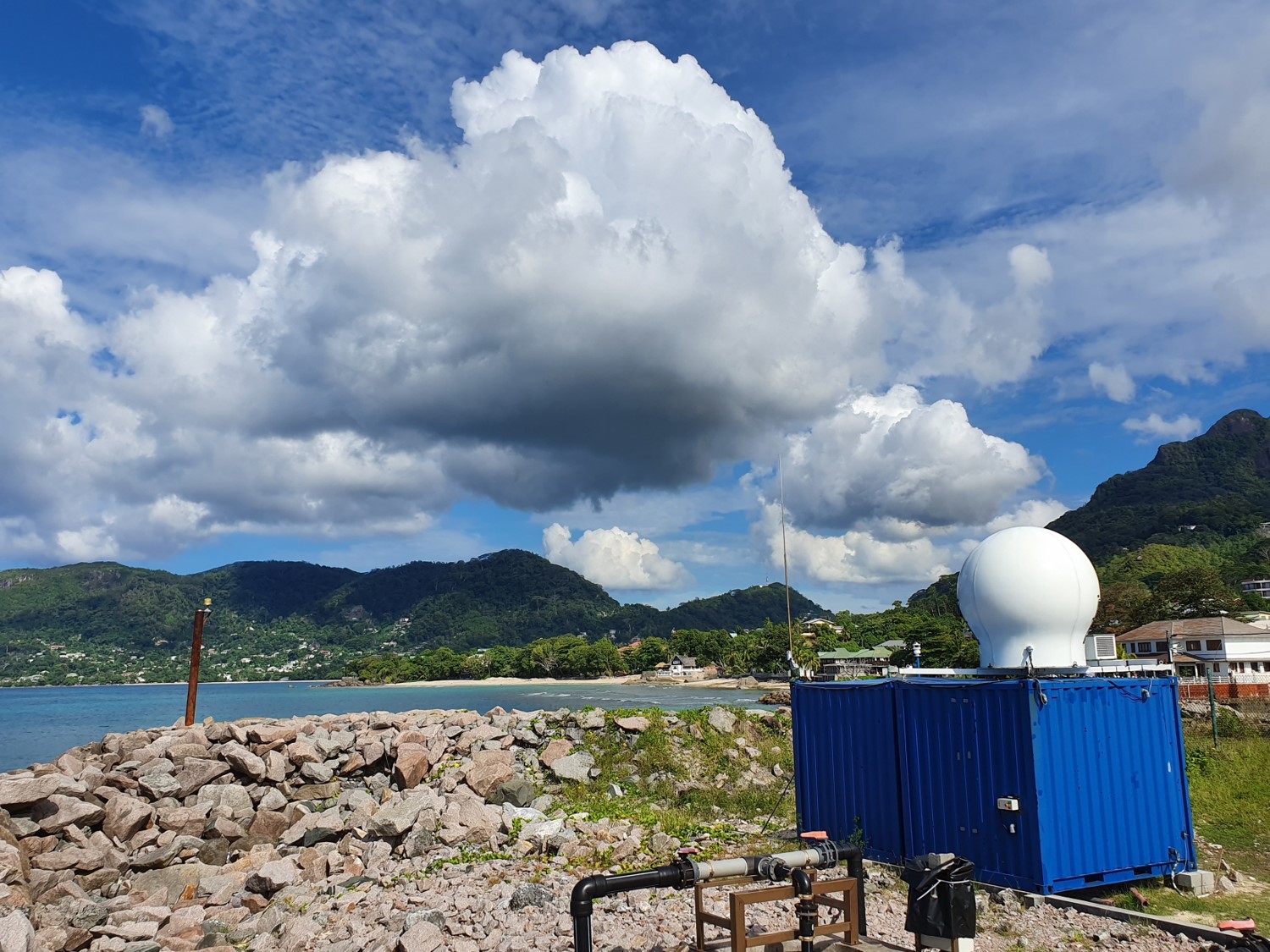
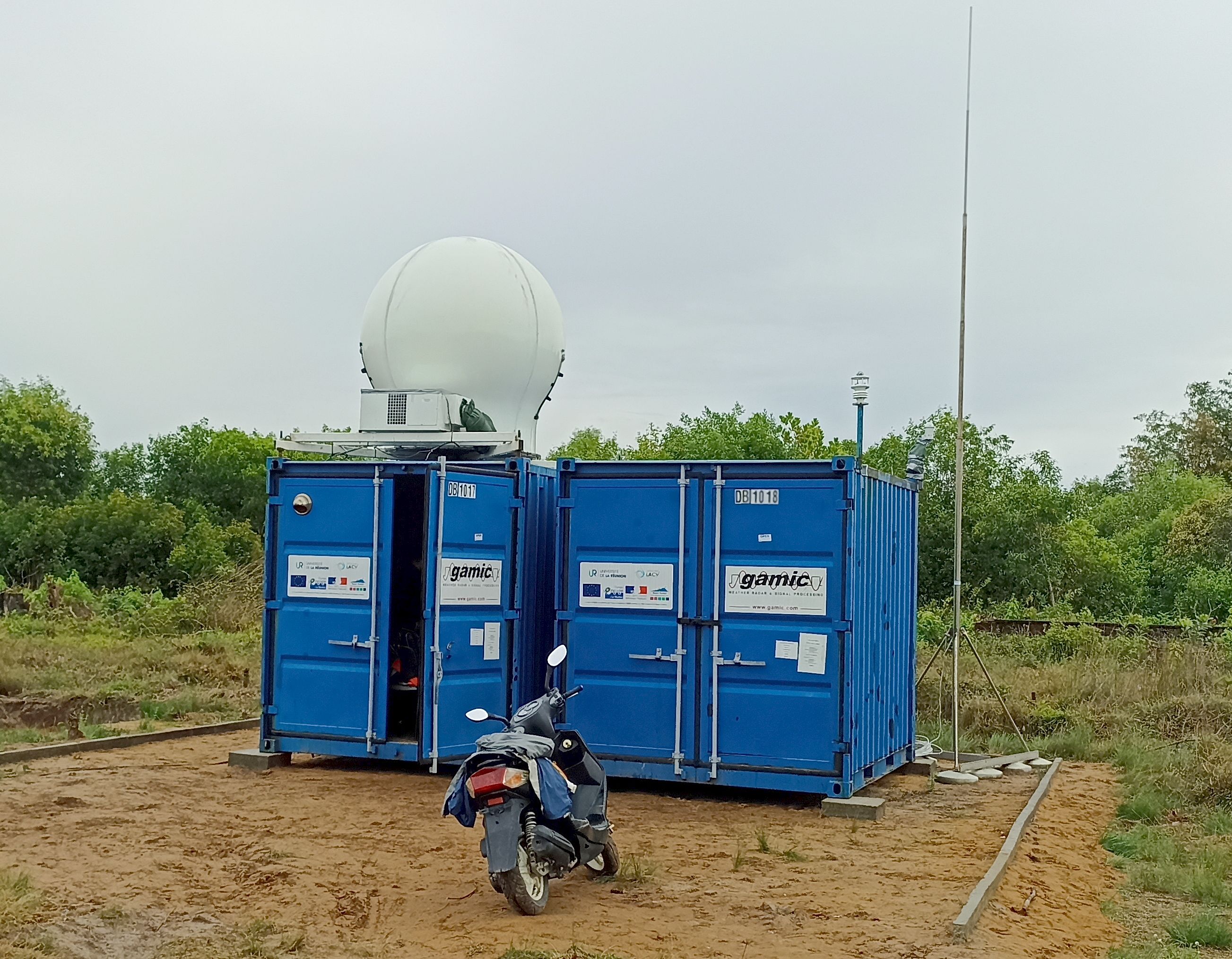
The ressource describes the dataset obtained by deploying the GAMIC GMWR-25-DP RADAR in the South of Reunion Island, in Saint Joseph.
-
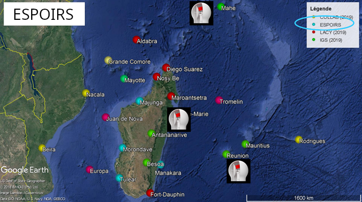
This ressource is part of the action 1 of the ESPOIRS Project. Multiple GNSS Stations have been installed or updated in the SWIO and the data are available here. "TO ADD : Different datasets, list of stations, etc ...."
-
The ressource describes the dataset obtained by deploying the GAMIC GMWR-25-DP RADAR in Toamasina (Tamatave) in Madagascar.
-

The overall objective of the ESPOIRS project is to obtain a better understanding of the variability, statistical properties and formation mechanisms of intense tropical precipitation at regional and local scales. ESPOIRS is thus interested in the entire life cycle of precipitation at several space-time scales. * Through the analysis of the distribution of the large-scale humidity field which drives the formation of precipitation at the regional scale using a GNSS network. * Through the characterization of internal (dynamics, microphysics) and external (interactions with the relief) processes, which drive the formation and life cycle of extreme weather events at the local scale => transportable Polarized Doppler X-band precipitation radar.